
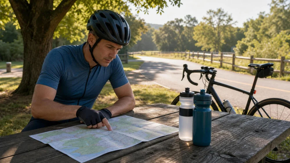
How to Plan a Bike Route With Reliable Water Stops
On this page
Quick answer
Plan water stops by time and difficulty, not distance alone. Mark confirmed public fountains, staffed businesses, visitor centers, and safe bailout points, then verify hours and seasonal availability close to departure. Carry enough water to reach the next dependable option plus a margin. In heat, remote terrain, or uncertain conditions, shorten the route rather than relying on an unverified source.
This guide is for recreational cyclists planning rides in the United States. Hydration needs vary with weather, effort, health, clothing, and the individual. It offers route-planning principles, not a universal drinking amount or medical advice.
Define the ride before mapping
A reliable water plan begins with an honest description of the ride. Note expected duration, climbing, surface, shade, traffic exposure, group pace, and how far the route travels from services. Ten flat paved miles near open businesses can present a different problem from ten steep gravel miles without cell coverage.
Estimate time conservatively. Include stops, navigation errors, mechanical problems, headwinds, and the slowest rider in the group. A route that is familiar to a strong local cyclist may take a visitor much longer.
Before choosing stops, ask:
- Where does the route become remote or difficult to shorten?
- Which sections are exposed to heat, wind, or direct sun?
- Will the ride occur before shops open or after facilities close?
- Are parks, campgrounds, or visitor centers operating this season?
- Can every rider carry enough water between dependable stops?
- Where can the group safely turn around or exit?
Find realistic water options
Use several sources to locate possible stops: official park and trail pages, municipal facility information, current business listings, route notes, and recent reports from local cycling groups. Treat crowdsourced map symbols as leads to verify, not guarantees.
Potential sources include staffed convenience stores, cafes, bike shops that advertise rider amenities, visitor centers, recreation buildings, campgrounds, and public fountains. A blue line on a map—a creek, spring, lake, or irrigation channel—is not automatically safe drinking water. Natural water may contain microorganisms or other contaminants, and access may be private, unsafe, dry, or prohibited.
Choose stops that do not require risky road crossings, riding against traffic, or leaving a bicycle unsecured in an isolated place. For a group, check whether the location can handle several bikes without blocking entrances or sidewalks.
Verify every important stop
A stop is dependable only when it is likely to be accessible during the ride. Check the official source or contact the operator when a single facility is essential to the plan.
- Confirm location. Make sure the entrance is on the side of the road or trail you can actually reach.
- Check current hours. Look for holiday, weekend, and seasonal differences.
- Confirm the service. A park may be open while its fountain or restroom is shut off.
- Check payment options. Small or remote businesses may not support every payment method or may have limited stock.
- Review recent conditions. Closures, construction, wildfire restrictions, storms, or water-system repairs can change access quickly.
- Save offline details. Keep the address, phone number, and route cue available when cell service is weak.
Recheck critical stops the evening before or morning of the ride. A screenshot from months ago is not confirmation.
Build backup options
For each essential water stop, identify what you will do if it is closed. The backup might be another staffed location, a shorter loop, a return route, a pickup point, or carrying more capacity from the start.
Set decision points before riding. For example: if the first confirmed refill is unavailable, turn onto the shorter loop rather than continuing into the longest service gap. A decision made calmly at the planning stage is easier to follow than one made when riders are already tired.
Do not make the plan depend on asking a private resident for water, entering restricted property, or assuming another cyclist will help. Those may become emergency options, but they are not reliable route infrastructure.
Ride-day checklist
- Check the current forecast, heat advisories, air quality, and relevant closures.
- Fill every planned bottle or hydration reservoir before leaving.
- Inspect containers for leaks and confirm cages or packs hold them securely.
- Carry the route and bailout points offline.
- Tell the group where the long gaps and decision points occur.
- Confirm that each rider has suitable carrying capacity; do not assume bottles can be shared.
- Start with the shorter option when conditions are worse than expected.
On group rides, make water checks explicit. A quick question at each regroup—“Does everyone have enough to reach the confirmed stop?”—is more useful than assuming silence means yes.
Weather and warning signs
Heat, humidity, altitude, wind, and sustained climbing can make a planned gap harder than it looks. Cold weather can also reduce the urge to drink while effort and fluid loss continue. Adjust the route and supplies to actual conditions.
Stop riding and address symptoms such as confusion, fainting, severe weakness, loss of coordination, or worsening illness. These can require urgent help. Do not use an online article to diagnose or manage a medical emergency; contact emergency services when appropriate.
The best time to shorten a route is before the group enters an exposed or remote section. Turning around is a sound planning decision, not a failed ride.
Limitations and important notes
- Public fountains and campground systems may be seasonal, damaged, shut off, or subject to advisories.
- Business hours and access can change without a mapping service updating immediately.
- Natural water requires appropriate treatment and informed judgment; visual clarity does not prove safety.
- Water alone does not address every nutrition, electrolyte, heat, or medical need.
- Remote rides may require specialized planning, treatment equipment, emergency communication, and local knowledge beyond this general guide.
Frequently asked questions
How far apart should bike-route water stops be?
There is no safe universal distance. Plan by expected time, effort, weather, rider needs, and carrying capacity. Shorten the gap when conditions are hot, exposed, steep, remote, or uncertain.
Can I rely on a park drinking fountain shown on a map?
No. Verify the facility through a current official source when it is essential. Fountains may be seasonal or temporarily unavailable even when the park remains open.
Should I plan around stores or public facilities?
Use the options that are verifiably open, accessible, and safe for the route. Staffed businesses may offer clearer hours, while public facilities may be more convenient but seasonal. Build a backup either way.
What if the group has different water needs?
Plan for each person rather than an average. Use the pace and capacity of the rider who needs the shortest interval, and make sure no essential supply is concentrated on one bicycle.
Is stream water safe if it looks clean?
Appearance does not establish safety. Natural sources can contain hazards that cannot be seen. Riders relying on backcountry water need suitable treatment knowledge and current local information.
Sources and evidence notes
This article uses broad outdoor-safety and route-planning principles: verify critical resources, carry a margin, account for changing conditions, and create bailout decisions before entering remote terrain. Official land managers, facility operators, weather services, and qualified health professionals are the appropriate sources for current local conditions and individual medical needs.
Plan your next route
Open your planned route and mark the longest time gap between dependable services. Verify the most important stop, add one backup, and choose a clear point where you will shorten the ride if water or conditions are not as expected. Save those details offline and recheck them before departure.
 Pedego Electric Bikes Tampa4.0 (110 reviews)
 Cadence Cyclery of Encinitas4.0 (277 reviews)
 Cruiser Bikes New York0.0 (0 reviews)
 Budget Pro Bicycles4.0 (112 reviews)
 Kreb Cycle Eastport4.0 (56 reviews)
 Bucephalus Bikes4.0 (122 reviews)
 How to Teach Kids to Ride a Bike: A Step-by-Step Guide for Parents
 Tips for Riding on Busy City Streets: Smart Strategies for Urban Cyclists
 Best US National Parks for Mountain Biking: Ride Epic Trails Across America
 Best Aero Helmets for Time Trials and Racing
 How to Clean and Lubricate Your Bike Chain Like a Pro
 10 Must-Have Items for Long-Distance Cycling Trips